Shaping California’s Future: Cal Poly to Lead the Charge for Greener Cities
Cal Poly is leading an effort to broaden California’s urban tree canopy and foster greener communities. In partnership with Cal Fire, the university will develop the state’s urban forestry plan to boost biodiversity, bolster climate resilience and widen access to green spaces.
Mandated by Assembly Bill 2251, the plan aims for a 10% increase in canopy cover by 2035, providing a statewide framework to sustain California’s urban forests long-term.
“Guiding this strategic plan gives Cal Poly students a direct path to using their data to solve real-world problems,” said biology Professor Jenn Yost, a lead on the project. “We have the strongest tree-mapping datasets anywhere.”
With over 8 million data points powering its neural network, Cal Poly has become a central authority in urban tree mapping — revealing where tree cover is most needed. The project unites biologists, computer scientists and social scientists, demonstrating the power of data and collaboration.
“We have computer science students learning botany and biologists learning to code,” said Jonathan Ventura, a computer science professor who helped develop the AI model that mapped millions of trees across California.
Under the leadership of Cal Poly’s Urban Forest Ecosystems Institute (UFEI), the initiative blends cutting-edge technology with environmental stewardship, reimagining cityscapes and preparing future engineers and scientists to tackle pressing ecological challenges.
• • •
Before assessing canopy cover, the UFEI team had to determine how many trees existed in California. What began as a biology-focused effort grew into an interdisciplinary collaboration spanning computer science, social science and geography.
Biology Professors Yost and Matt Ritter started by compiling data from tree companies that had mapped municipal streets. But since public trees account for only 20% of the urban forest, they needed a broader view.
“Why not just put AI magic to work?” suggested Ventura, who teamed up with geography Professor Andrew Fricker, an expert in GIS and AI model refinement. However, detecting trees from aerial images was more challenging than expected.
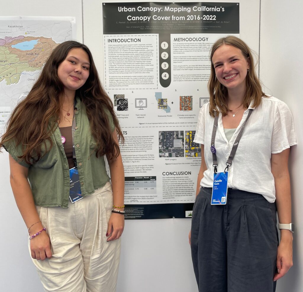
That’s where Cami Pawlak, a biology master’s student from Playa Vista, California, stepped in. She coordinated a team of students who manually identified 100,000 trees using aerial imagery — a process that took two years.
One big challenge was defining a tree. “What is a tree? What is a bush? Those were actual debates,” she recalled with a laugh.
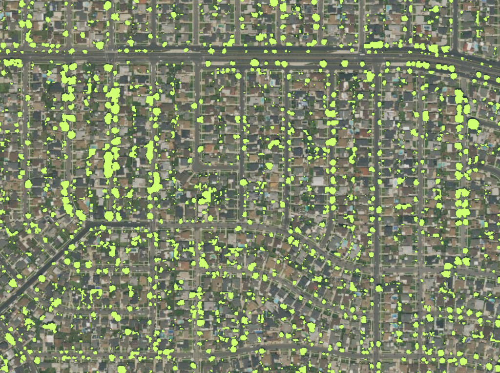
After marking enough points, the team developed a neural network that eventually mapped 40 million trees statewide — a feat that would have taken lifetimes by hand.
With mapping complete, the UFEI team turned to analyzing California’s urban forests. Their statewide inventory of 7.8 million trees, representing 552 species, offered an in-depth look at diversity by city and county, as well as climate zones and drought resilience.
Biodiversity, they knew, was key to resilience. “If you plant only one kind of tree and that species gets a disease, every one of those trees is at risk. More diverse urban forests can withstand threats better,” Yost explained.
Their findings became the foundation for SelecTree, an online tool that helps users choose trees based on environmental conditions. To improve it further, computer science graduate student Daniel Gonzalez, from Lathrop, California, joined the effort.
As Gonzalez refined SelecTree, he was amazed to discover it had 25,000 monthly visitors, ranging from academics to Cal Fire officials. During that process, he also mentored undergraduates in cloud computing and picked up new insights about California’s urban forests — like the fact that crape myrtle is the state’s most popular tree. “The magic is in the data,” he said.
Now a senior engineer at Cisco, he remains deeply proud of his work’s lasting impact.
• • •
With a strong mapping foundation in place, UFEI turned to measuring California’s canopy coverage — a key metric for guiding policy decisions.
A well-planned tree canopy offers broad benefits, from reducing stormwater runoff and capturing carbon to improving mental health and lowering crime rates. By assessing tree cover, the team helps cities expand and maintain urban forests.
In summer 2023, four students began building training data for a new model, refining it through hand-annotated images and remote sensing data. With the workflow in place, the team continues its expansion. “Once fully operational, we’ll be able to track canopy changes year by year,” said Pawlak, who picked up coding skills while working with Ventura.
Their research is already shaping policy. Pacifica became the first city to use UFEI’s canopy model to guide urban planning, showcasing its real-world impact.
For Yost, however, the most rewarding part is seeing students grow. “The coolest aspect is seeing computer science students start recognizing trees,” she said. “Sometimes I’ll get a text from one of them asking, ‘Isn’t this a certain type of tree?’ It’s such a great fusion of disciplines.”
Ventura agreed. “It’s not just about finding the right algorithm. It’s about what the data tells us and why it matters. This work connects students to real-world impact, far beyond abstract concepts.”
With cities eager for data, UFEI’s research is already shaping the future of California’s urban forests — while preparing the next generation of engineers and scientists to do the same.
Call to Action: Plant the Future!
You can play a vital role in shaping California’s greener future. Use the SelecTree tool to choose and plant the right tree for your area, helping increase canopy cover and improve urban environments. By making informed choices, you’re not just planting a tree — you’re contributing to cleaner air, healthier communities and a more sustainable world.